Highway Data Explorer Help
The Highway Data Explorer provides detailed information on highways throughout Colorado. The Search tab allows selection of highway segments in various ways. The other tabs display detailed information about the segments that have been selected.
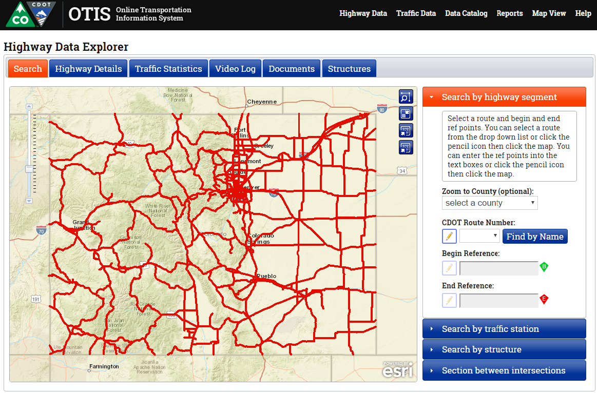
Selecting highway segments
Highway segments can be selected in the following ways:
- By route number or name and begin/ end mile points.
- By traffic station
- By intersection
Selecting by route and reference points
To select highway segments by route and reference points, click the 'Search by highway segment' accordion pane to the right of the map. Then select the route by selecting it from the route number dropdown, by clicking the pencil icon next to the dropdown and clicking the route on the map, or by clicking the find by name button and selecting the route by its local name from the dialog box. Next, select the begin and end reference points by typing them into the textboxes or by clicking the pencil icon next to the textboxes and then clicking the location on the map.
Selecting by traffic station
To select highway segments by traffic station, click the 'Search by traffic station' accordion pane to the right of the map. Then type in the station id and hit enter or click the pencil icon and click the traffic station on the map.
Selecting by intersections
To select highway segments by intersection, click the 'Search between intersections' accordion pane to the right of the map. Then select the route by selecting it from the route number dropdown, by clicking the pencil icon next to the dropdown and clicking the route on the map, or by clicking the find by name button and selecting the route by its local name from the dialog box. Next, select the start intersection by clicking the Find by Cross-Street button and selecting an intersection from the list or by clicking the pencil icon and clicking the intersection on the map. Finally, select the end intersection by clicking the radio button in front of the desired intersection.
Viewing highway data
When a highway segment has been selected. Detailed information about it can be viewed on the various other tabs. Each tab contains several sections. Each segment can be expanded/ collapsed by clicking its heading. The data for each section can be exported to an Excel-compatible CSV file by clicking the Export to Excel button.
On the Highway Details tab, there is a Create Straight Line Diagram button which links to the Straight Line Diagram tool for the selected segment.
The Video Log tab displays sequential images along the selected highway segment.